Space Weather in 2026: Why the Solar Maximum Drags Satellites Out of Orbit, What a G5 Storm Does to GPS and Power Grids, and How to Read the Forecast Before It Hits
- Equipo de Internet Pros
- September 28, 2026
- Redes y Seguridad
Este artículo está disponible solo en inglés.
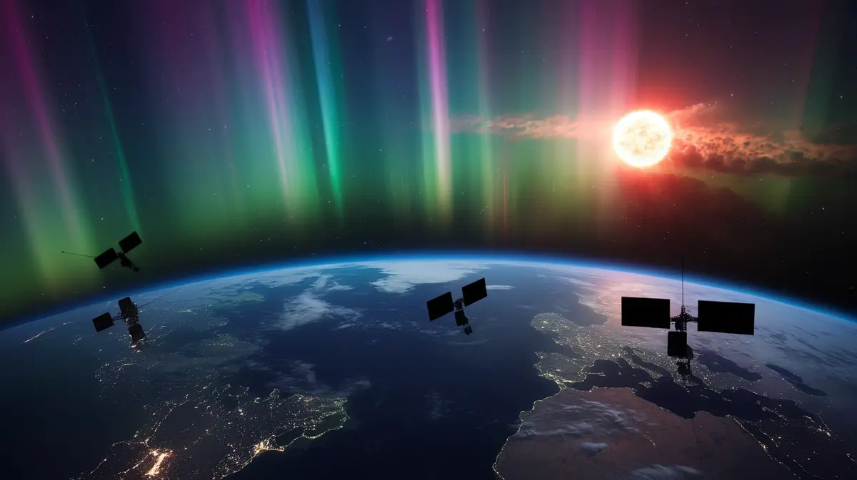
In May 2024 the aurora borealis was photographed as far south as Florida and Mexico. It was beautiful, and it was also the first G5 geomagnetic storm, the top of the scale, in more than twenty years. Farmers in the US Midwest watched GPS-guided tractors drift off their rows in the middle of planting season. Satellite operators saw their spacecraft sink faster than planned. Grid operators quietly adjusted their networks. The Sun is now past the peak of Solar Cycle 25, but the stretch just after a maximum is when some of the biggest storms have historically arrived. Space weather has moved from a curiosity for astronomers to a line item in business continuity planning.
What Space Weather Actually Is
The Sun follows a roughly eleven-year cycle of activity. Near the peak, sunspots multiply and three kinds of events become common:
- Solar flares. Bursts of X-rays and extreme ultraviolet light that reach Earth in about eight minutes and disrupt high-frequency radio on the sunlit side of the planet.
- Solar energetic particles. Protons accelerated to high speeds that arrive within minutes to hours and threaten satellite electronics, astronauts and polar flights.
- Coronal mass ejections (CMEs). Billions of tonnes of magnetised plasma thrown into space. A fast CME reaches Earth in one to three days, and if its magnetic field points the wrong way it couples with Earth’s magnetic field and triggers a geomagnetic storm.
It is the CMEs that cause most of the expensive trouble, because the storms they trigger can last a day or more and affect everything from orbit down to buried pipelines.
A flare is a flash of light that arrives before anyone can react. A CME is a slow-moving freight train, and the one or two days it spends in transit are your warning time.
Reading the Forecast: The G, S and R Scales
The US National Oceanic and Atmospheric Administration (NOAA) Space Weather Prediction Center publishes alerts on three five-step scales, similar in spirit to hurricane categories. Knowing which letter you are looking at tells you which systems are at risk.
| Scale | What it measures | What it affects |
|---|---|---|
| G1 to G5 (geomagnetic storms) | Disturbance of Earth’s magnetic field, tied to the Kp index; G5 corresponds to Kp 9, the maximum | Power grids, GPS accuracy, satellite drag and orientation, pipelines |
| S1 to S5 (solar radiation storms) | Flux of high-energy protons near Earth | Satellite electronics, astronauts, polar air routes and HF radio near the poles |
| R1 to R5 (radio blackouts) | X-ray intensity from solar flares | High-frequency radio and some navigation signals on the sunlit side, for minutes to hours |
Most storms sit at G1 or G2 and cause little more than visible aurora at high latitudes. G4 and G5 events are rare, a handful per cycle, but they are the ones that justify a plan.
Why Satellites Fall Faster During a Storm
A geomagnetic storm heats and expands Earth’s upper atmosphere. Satellites in low Earth orbit suddenly fly through denser air, feel more drag and lose altitude. In February 2022 a fairly minor storm struck just after SpaceX launched a batch of 49 Starlink satellites into a low deployment orbit; about 38 of them re-entered before they could climb to safety.
Storms also build up electric charge on spacecraft surfaces and let energetic particles flip bits in onboard memory. For customers of satellite internet, that can mean brief outages or degraded service while constellations recover.
GPS, Timing and the Ionosphere
GPS signals pass through the ionosphere, a layer of charged gas that a storm turns turbulent. The result is scintillation: the signal fades and flickers, receivers lose lock, and position errors grow from centimetres to metres. Precision users feel it first. Surveying crews, construction machine control and the RTK systems that guide farm equipment all depend on centimetre-level corrections that break down in a strong storm.
Fewer people realise how much of the world’s infrastructure uses GPS as a clock rather than a map. Cellular networks, financial trading systems and data centres often discipline their time servers from satellite signals. If you have not already, read our guide to network time synchronisation; a good holdover oscillator and multiple time sources turn a space weather event from an outage into a non-event. The same logic drives the push for resilient navigation beyond GPS.
The Grid: Where the Worst Case Lives
A changing magnetic field induces electric currents in anything long and conductive. On the ground, that means geomagnetically induced currents (GICs) flowing into high-voltage transmission lines through transformer grounds. These slow, almost-direct currents push transformers into saturation, make them overheat and hum, and confuse protective relays.
The textbook example is 13 March 1989, when a storm collapsed the Hydro-Québec grid in about 90 seconds and left some six million people without power for roughly nine hours. In 2003 a storm caused a short blackout in Malmö, Sweden. A repeat of the 1859 Carrington Event, the largest storm on record, would stress far larger grids.
Utilities are better prepared than they were in 1989. North American operators must assess their exposure under the NERC TPL-007 standard, many now monitor GICs in real time, and some have installed blocking devices on vulnerable transformers. Still, large transformers take many months to replace, which is why grid operators take G4 and G5 watches seriously.
How Forecasting Got Better
The GOES-19 satellite carries a compact coronagraph that watches CMEs leave the Sun. At the L1 point, 1.5 million kilometres toward the Sun, spacecraft such as DSCOVR and NOAA’s SWFO-L1, launched in September 2025, measure the incoming solar wind and its magnetic orientation. That final measurement gives only about 15 to 60 minutes of warning, but it is the one that tells forecasters whether an approaching CME will actually cause a severe storm.
A Space Weather Checklist for Businesses
- Subscribe to alerts. NOAA SWPC issues free watches, warnings and alerts by email; route G4 and above to whoever owns your continuity plan.
- Know your GPS dependencies. List every system that uses satellite positioning or timing: fleet tracking, time servers, surveying gear, payment terminals.
- Add a second time source. Combine GPS with NTP from diverse providers, or a PTP grandmaster with a good holdover oscillator.
- Have a backup link that is not satellite. If satellite internet is your primary or failover connection, pair it with fibre, cable or cellular.
- Plan for power interruptions. A UPS, a tested generator and graceful shutdown scripts cover space weather the same way they cover a summer thunderstorm.
En resumen
Solar storms are not a doomsday scenario, but they are a real and recurring risk to the systems modern businesses quietly depend on: satellites, GPS timing and the power grid. The Sun will stay unusually active through 2026, and a warning of a day or two is plenty of time to act if you already know what to check. Treat space weather like any other natural hazard and plan once, rather than scrambling when the aurora shows up in your sky.
Not sure how much of your network depends on GPS time or a single satellite link? Talk to Internet Pros. We map those dependencies, add redundant time and connectivity, and set up alerting so the next solar storm stays a light show rather than an outage.